Use iOS LiDAR to capture model-aligned 3D scans
Sitelink enables anyone onsite to take quick and easy point cloud scans of existing conditions, using the LiDAR function on their mobile device. No heavy setup or specialized hardware needed.
Aligns to your coordinated model in Navisworks.
Capturing your jobsite in real-time is easy
Field teams can now rapidly capture real-world conditions on the jobsite, creating point cloud data on-the-go, in a matter of moments. Whether it's for quick QA/QC checks, capturing as-built conditions, identifying obstructions, issues for immediate resolution, or unforeseen conditions, this speed and simplicity translate into:
quicker decision-making
reduced project downtime
enhanced collaboration.
Compare existing conditions to the design
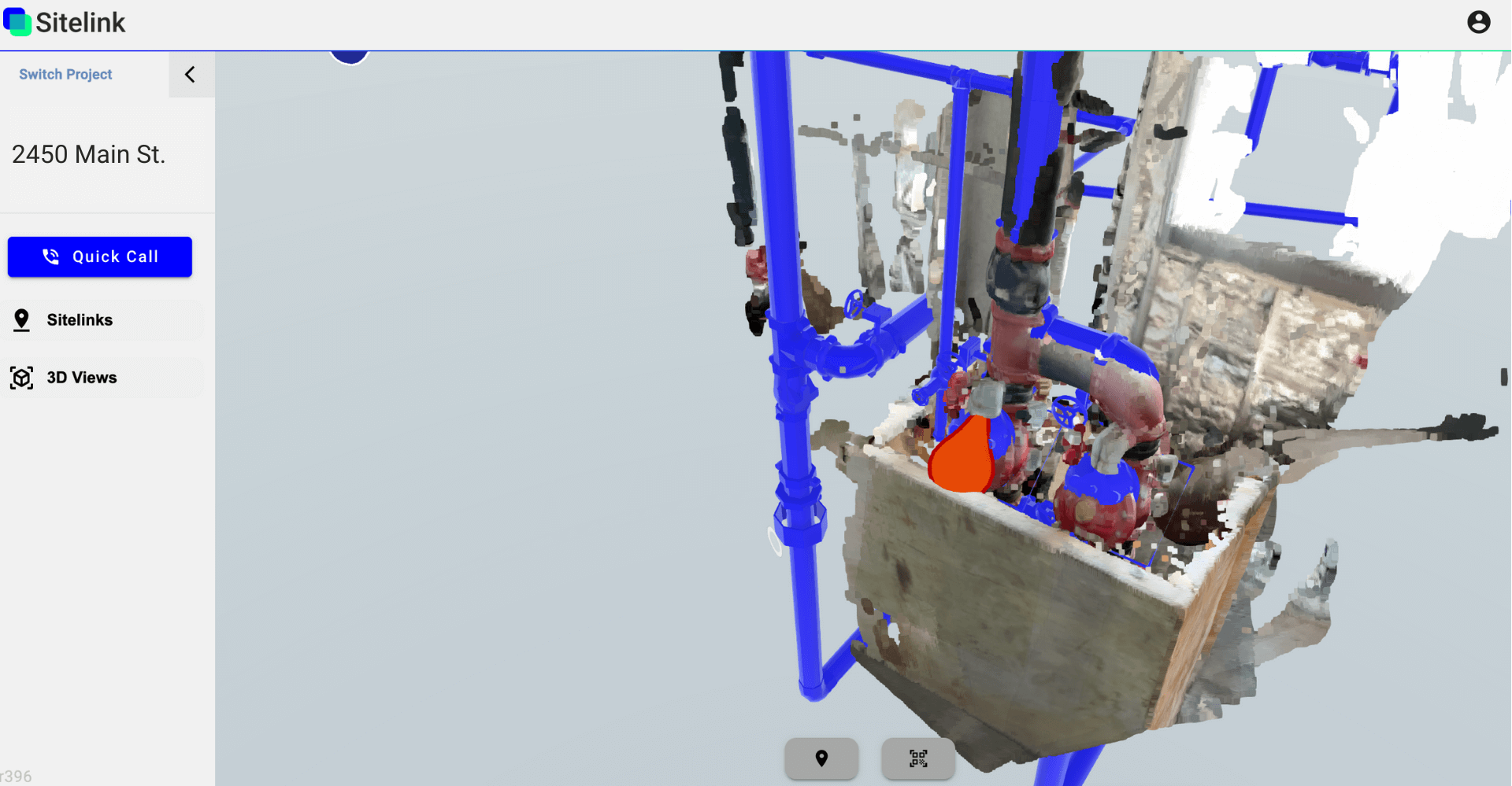
Your point cloud captures integrate within the context of your BIM model - in Sitelinks web viewer and Autodesk Navisworks.
This capability enables users to overlay 3D point cloud data onto the digital design, providing a comprehensive view of the real-world conditions at the jobsite.
By combining point cloud scans with the BIM model, construction teams can identify clashes, verify accuracy, and make informed decisions with unparalleled accuracy.
Point cloud scanning FAQ
How large of a point cloud scan can I capture?
Sitelink is optimized for efficient, targeted data capture rather than large-scale scans of entire jobsites. We focus on capturing specific sections where issues arise, enabling rapid problem-solving. Sitelink is particularly efficient with scans around 100MB, for quick capture and processing times.
What is the accuracy of the point cloud scans?
For point cloud scans captured with Sitelink, measurements typically fall within +/- 2 inches on average.This precision holds true for distances of acquisition of up to 5 meters, ensuring reliable and detailed data capture within this range.
How long does it take to capture and upload a scan?
We focus on speed and ease of use. Capturing and uploading scans from your mobile device takes minutes.
How can I view my point cloud scans?
You can view your Sitelink point cloud scans on your desktop, alongside your BIM model. This feature allows you to analyze your scans comprehensively using our 3D viewer, all within a familiar desktop environment.
What devices can I use for point cloud capture?
To take advantage of Sitelink’s LiDAR-enabled point cloud scanning capabilities, you’ll need an iPhone 12-14 Pro, an iPhone 12-14 Pro Max, or a 2020-2022 iPad Pro.
Can I export my point cloud captures?
Yes, you can save or export your point cloud scans (or share them with anyone) right form your mobile device. Currently, point cloud scans are exported in .PLY format.
Capture critical data on the go
“We couldn’t verify the newly installed pumps and housekeeping pads in the field. Everything was slightly off vs. the model. We were seeking a solution that would allow us to quickly verify existing conditions.
Laser scanning was too extensive, while using a tape measure alone required minimal effort but lacked the necessary precision.”